
Choosing an app for the Cotswold Way
| Cotswold Way Team

There is not one universal best app for the Cotswold Way. The right choice depends on whether you want a trail-specific planner, a general outdoor app you already use, or a simple GPX line on your phone. This guide compares the options covered on our Cotswold Way apps and GPX page so you can match tools to your itinerary - not chase a fake ranking.
The Cotswold Way National Trail runs about 102 miles from Chipping Campden to Bath. Most through-walkers take 7 to 10 days across official stages. An app helps with GPS tracking, offline maps, trail notes, and day-by-day planning. Keep a paper map or guidebook as your primary reference, download maps on Wi-Fi, and pack a power bank for longer days.
How to choose a Cotswold Way app
Start with the job you need the phone to do, then check cost and familiarity.
- Trail-specific planning. Day-by-day itineraries, accommodation and food pins, and walker tips for this National Trail point toward the Cotswold Way app.
- Familiar generalist tools. If you already log hikes in AllTrails, Komoot, or Gaia GPS, sticking with that ecosystem is valid - especially for trip reports, elevation previews, or detailed topo layers.
- Offline access. Offline maps on generalist apps often need a paid plan. The Cotswold Way app includes offline GPS without a subscription; GPX viewers can also work offline once the file is saved.
- Cost model. Prefer free trail tools if you do not want another outdoor subscription for a single long-distance walk.
If you are in doubt and still weighing which app is best, the Cotswold Way app is a good starting point. Try it and see whether it fits your needs - because it is dedicated to this National Trail, it may already do exactly the job you are hoping for.
Pair your choice with a realistic 7 vs 10 day Cotswold Way itinerary so daily distances match what your phone - and legs - can manage.
Cotswold Way apps compared
Use this table as a quick filter. Details and caveats sit in the per-app sections below.
| Feature | Cotswold Way app | AllTrails | Komoot | Gaia GPS |
|---|---|---|---|---|
| Built for this National Trail | Yes - trail planner and navigator | Full route and shorter sections listed | Full hike with staged collections | Import GPX or follow community routes |
| Offline maps / GPS | Offline GPS route following | Offline maps usually need a paid plan | Offline maps need a Komoot subscription | Many offline layers need a subscription |
| Day-by-day itinerary planning | Yes - build itinerary day by day | Preview elevation and sections; general trip tools | Strong for comparing distance, elevation, surface | Flexible once GPX or routes are loaded |
| Community notes and tips | Walker tips, corrections, local knowledge | Trip reports | Community tips and photos | Community routes |
| Trail POIs (stays, food, sights) | Included | Varies by listing and reports | Varies by community detail | Depends on layers and imports |
| Cost model | Free to download; mission to stay free, always | Free tier; Premium for offline | Free tier; subscription for trail features | Free to try; subscription for many tools |
 Cotswold Way app
Overview
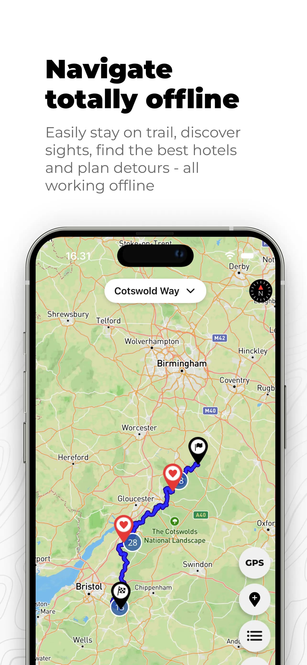
The Cotswold Way app is a trail planner and navigator built for this National Trail - more than a generic map. It is free to download for iPhone and Android, community supported, and designed so walkers can rely on it without a subscription. See store links on the apps page.
Strengths
- Day-by-day itinerary planner shaped around Cotswold Way stages and overnight hubs.
- Personal notes on the map - pin reminders where you need them on trail.
- Offline GPS route following when signal drops.
- Points of interest for accommodation, food, and sights along the route.
- Community contributions - tips, corrections, and local knowledge from people who know the trail. The app is kept up to date as the route and facilities change.
- Free download with a clear mission to stay free, always - useful if you do not want another outdoor subscription for one long walk.
Limitations
- Focused on the Cotswold Way rather than a worldwide hike library - if you need one app for every trip worldwide, a generalist may still sit beside it.
- Like any phone tool, it needs battery care and offline downloads before remote stages.
Best for
Walkers who want a free, Cotswold Way-specific planner with itinerary tools, map notes, offline GPS, and trail POIs - and who value community-maintained detail as facilities change.
 AllTrails
Overview
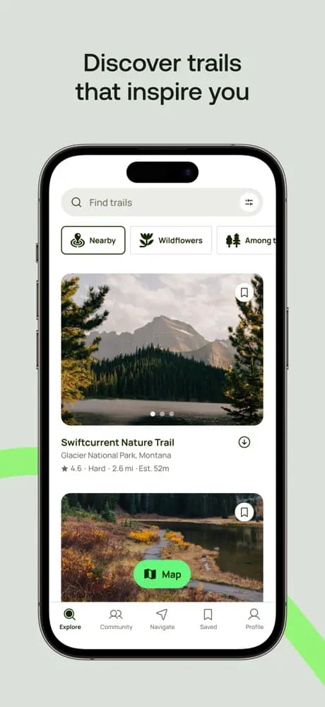
AllTrails is a popular outdoor app that lists the Cotswold Way as a full route and as shorter sections. Many walkers already use it for day hikes elsewhere, which makes it a familiar option on this trail too.
Strengths
- Preview elevation and follow the line on your phone along the listed route.
- Recent trip reports can surface conditions and practical notes from other walkers.
- Familiar interface if AllTrails is already your default outdoor app.
Limitations
- Offline maps usually need a paid plan - download before you leave Wi-Fi.
- Generalist coverage rather than a Cotswold Way-only planner with dedicated day-by-day itinerary and trail POI tools.
Best for
Walkers already invested in AllTrails who want elevation previews and trip reports, and who are comfortable with a paid plan for reliable offline maps.
 Komoot
Overview
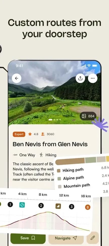
Komoot is a route planner and navigator used widely by outdoor enthusiasts. It lists the Cotswold Way as a full hike with staged collections you can adapt into your own itinerary.
Strengths
- Useful for comparing daily distances, elevation, and surface types before you set off.
- Staged collections help sketch a multi-day plan that matches your pace.
- Community tips and photos add local detail when you are comparing stages.
Limitations
- Turn-by-turn voice navigation, offline maps, and other trail features require a Komoot subscription.
- Not purpose-built solely for Cotswold Way accommodation and facilities planning the way a dedicated trail app is.
Best for
Walkers who like Komoot's planning workflow for multi-day hikes and already pay for - or plan to use - subscription features such as offline maps and voice navigation.
 Gaia GPS
Overview
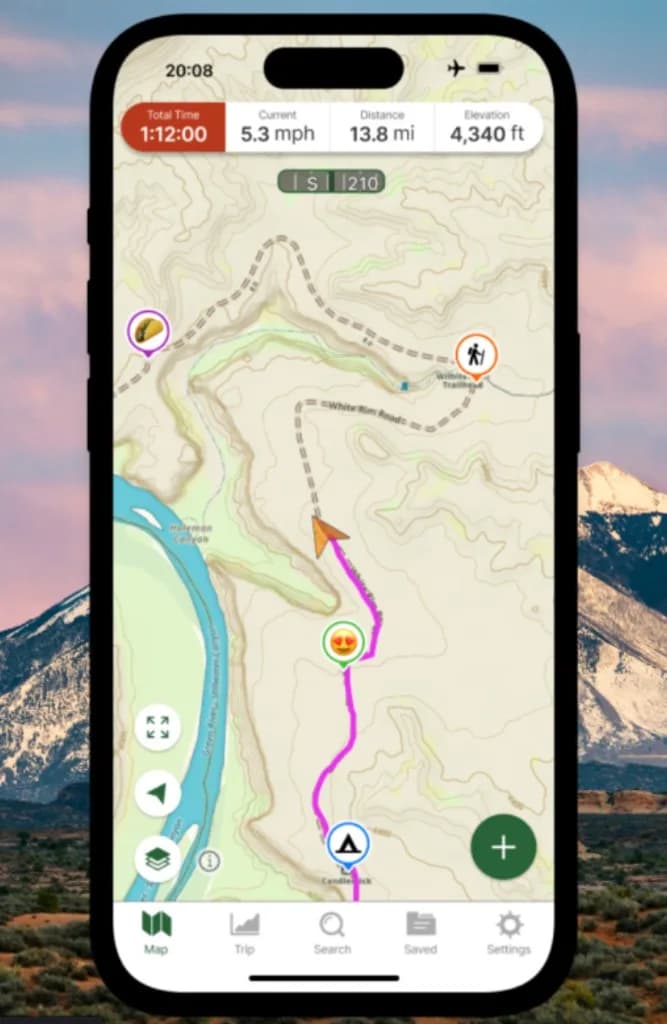
Gaia GPS is a topographic mapping app from Outside Inc., useful when you want detailed terrain layers, hill shading, and offline maps for hiking. You can import the Cotswold Way GPX file or follow community routes, then download map tiles before you leave Wi-Fi.
Strengths
- Strong topographic layers and hill shading for reading the escarpment terrain.
- Flexible GPX import if you want the official line inside a mapping toolkit you already trust.
- Free to try if you are evaluating whether Gaia fits this walk.
Limitations
- Many offline map layers and advanced tools need a Gaia GPS subscription.
- You assemble Cotswold Way context yourself via GPX or community routes rather than opening a ready-made trail itinerary product.
Best for
Walkers who already use Gaia elsewhere and want the same topographic toolkit on this National Trail, with GPX import for the Cotswold Way line.
GPX download as a lightweight option
You do not need a branded outdoor subscription to carry a digital line of the trail. Download the Cotswold Way as GPX for planning on a computer or importing into a GPS app. GPX is widely supported: free iOS and Android viewers can show your position on the route and work offline once the file is saved on your phone.
Treat GPX as an import path or lightweight backup alongside a fuller planner - not as a competing "app brand" in the same way as AllTrails or Komoot. Search your app store for GPX viewers if you only need the route line and your location.
Paper maps and guidebooks still matter
National Trail acorn waymarks help, but they are not enough on their own. Phones lose signal and battery. Use an app for live GPS and notes; keep a paper map or guidebook as the primary navigation layer. Browse the maps and navigation hub for the full set of options.
FAQ: Cotswold Way navigation apps
What is the best app for the Cotswold Way?
There is no single best Cotswold Way app for every walker. Choose by what you need on trail: day-by-day planning and trail-specific notes favour the free Cotswold Way app; AllTrails, Komoot, or Gaia GPS suit walkers who already live in those ecosystems and are happy with a paid plan for offline maps. If you are in doubt, the Cotswold Way app is a good starting point - because it is dedicated to this trail, it may already do the job you are hoping for.
Who should use the Cotswold Way app?
Use the Cotswold Way app if you want a free, trail-specific planner with day-by-day itineraries, personal map notes, offline GPS, and points of interest for accommodation, food, and sights - kept current through walker tips and corrections.
Can I use more than one Cotswold Way navigation app?
Yes. Many walkers keep a generalist app such as AllTrails, Komoot, or Gaia GPS for familiar tools, and add the Cotswold Way app or a GPX file for trail-specific planning. Download offline maps on Wi-Fi and carry a power bank either way.
Do I still need a paper map on the Cotswold Way?
Yes, treat a paper map or guidebook as your primary navigation and the phone as a live backup. Phones lose signal and battery; National Trail waymarks help, but they are not enough on their own in poor weather or at junctions.
Is there a free Cotswold Way GPS option?
The Cotswold Way app is free to download for iPhone and Android and is built to stay free without a subscription. You can also download the full trail GPX and open it in a free GPX viewer for a lightweight offline line on your phone.
Plan the next detail
Pick the app mix that matches how you already walk, then lock pacing and overnight hubs. Start with Cotswold Way apps and GPX, sketch days with a 7 vs 10 day itinerary, and walk the ground stage by stage via our Cotswold Way stages.