The Cotswold Way has long connected settlements, high ground, and places of worship.
The line of the trail follows ancient tracks and drove roads. Along the route you will pass hillforts, churches, manor houses, and remnants of the region's wool heritage - many of which are covered on our Sights page. Finishers can also join the Hall of Fame.
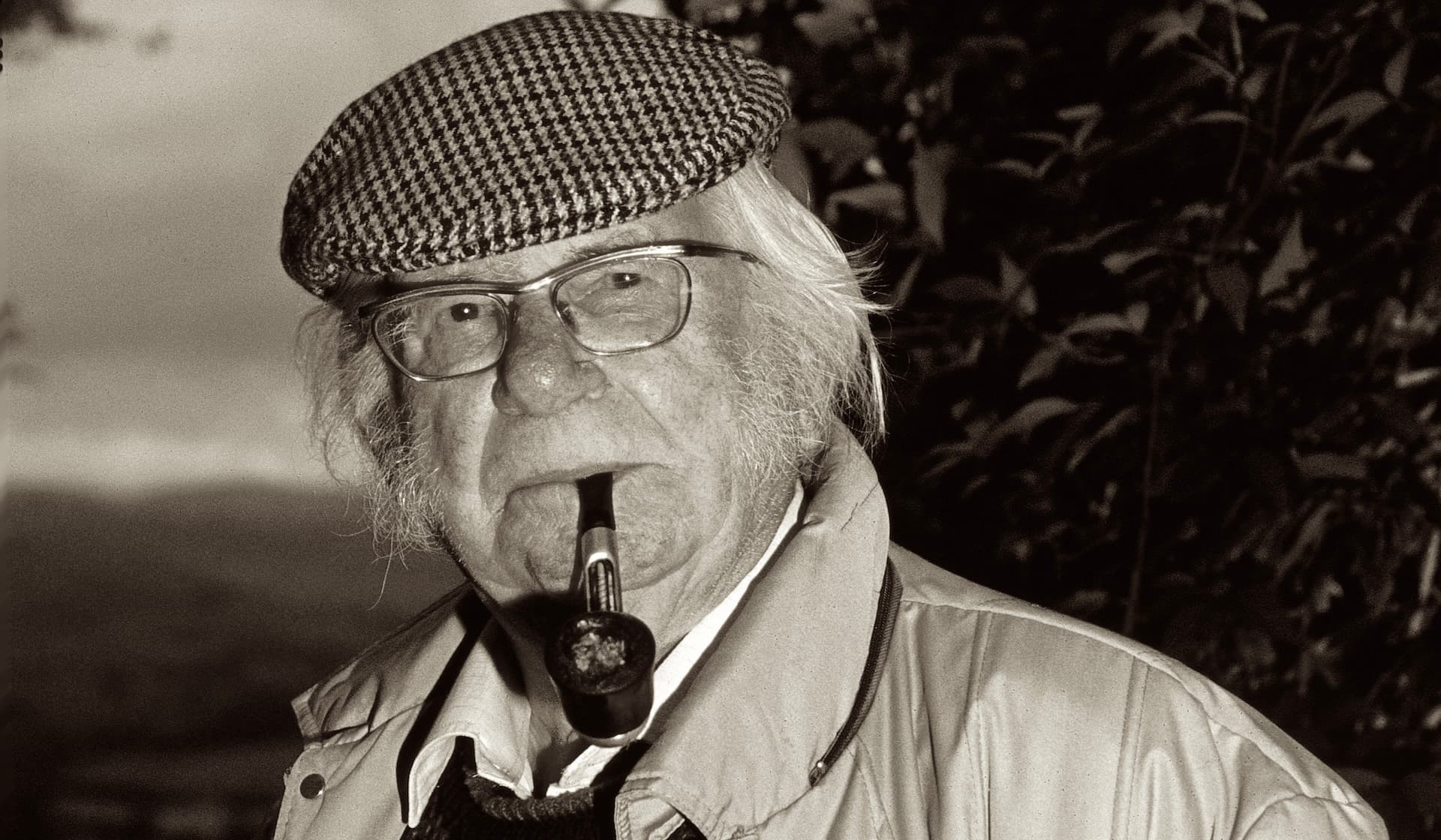
The concept of a continuous path along the escarpment was first proposed over 50 years ago by members of the Gloucestershire-area Ramblers. The two principal figures behind the vision were Tony Drake of Cheltenham and Cyril Trenfield of South Gloucestershire.
Following the National Parks and Access to the Countryside Act of 1949, which provided the legal framework for long-distance paths, Drake put forward the specific idea of a route following the Cotswold Edge. In 1953, the Gloucestershire Committee of the Ramblers Association submitted formal plans to the National Parks Commission.
Although the commission acknowledged the proposal in its annual report that year, the plans were effectively pigeonholed and largely forgotten for over a decade.
The project was revived in 1968 when Gloucestershire County Council included the route in its recreational plan for the countryside. Because the council did not have the specific powers to create new footpaths at the time, the original trail was designed using only existing public rights of way.
The scheme was officially launched during Footpath Week in May 1970. In its early years, while the path was prioritised for signposting, it lacked the government grants available to official national routes, meaning local volunteers and wardens were essential for its maintenance.
The trail's reputation grew significantly in 1973 when rambler Mark Richards published an early guide to the Way. This guide used the hand-drawn pictorial style popularised by Alfred Wainwright, making the route more accessible and appealing to a wider audience of hikers. Over the following decades, the trail became celebrated for its diversity, passing iconic sites like the Neolithic long barrow at Belas Knap, Hailes Abbey, and Broadway Tower. The long-standing goal of official recognition was finally achieved on 24 May 2007, when the Cotswold Way was formally inaugurated as an official National Trail. This designation allowed for the creation of several new rights of way to improve the route and introduced the signature acorn waymarkers used to guide hikers along the 102-mile journey.
The trail celebrated its 50th anniversary in 2020, marking a half-century since its initial launch by the County Council. The contributions of its founders are permanently recognised along the path through specific memorials:
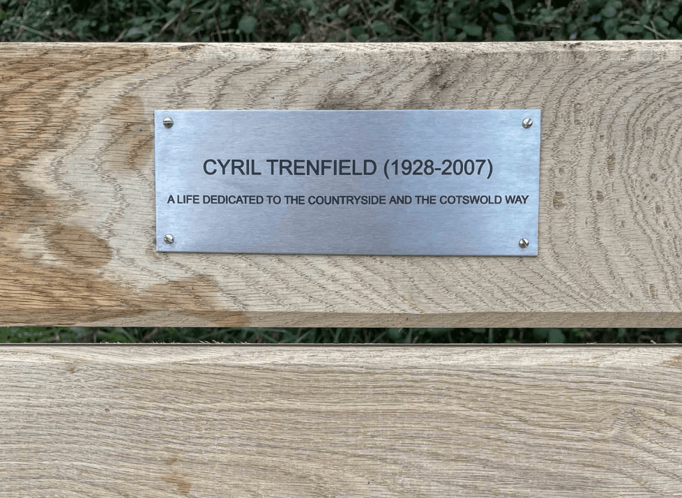
The bench, which had rotted over time, was recently replaced by the Cotswold Way Association and moved to a new location providing fine views across the Severn Valley. Recent history has also seen the development of unique trail traditions, such as the message box in Dyrham Wood. Placed approximately 20 years ago, this box contains a living archive where thousands of walkers record their personal stories and reflections as they near the trail's end in Bath. Today, the trail is maintained by the Cotswolds National Landscape team and a dedicated group of Cotswold Voluntary Wardens. For guided walks and trail contacts, see Community and expert guidance.


