
The Way
Prepare your journey with practical FAQs, weather guidance, and route planning advice.
Read moreA 102-mile National Trail from Chipping Campden to Bath, passing through Cotswold villages, beech woodland, and wide escarpment views.
Plan Your Route


Explore
The Cotswold Way is a 102-mile National Trail along the western edge of the Cotswold Hills, from the market town of Chipping Campden in Gloucestershire to the city of Bath in Somerset. The route climbs onto open escarpment, drops into sheltered combes, and threads through some of England's best-known stone-built villages - often with long views across the Severn Vale and beyond.
Prepare your journey with practical FAQs, weather guidance, and route planning advice.
Read more
Plan daily sections and pacing for walking the trail from Chipping Campden to Bath.
Read more
Explore walking, cycling and horse-riding opportunities along the Cotswold escarpment.
Read more
Discover accommodation including B&Bs, inns, campsites, and self-catering options.
Read more
Read latest notices on path conditions, events, and local updates for walkers.
Read more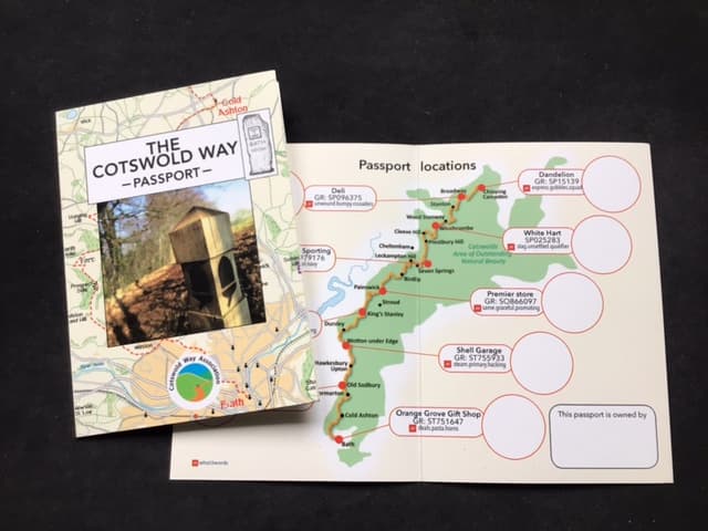
Celebrate your finish: Hall of Fame, Walker's Passport, certificates, and trail community programmes.
Read more
The National Trail is waymarked for walkers from Chipping Campden to Bath - plan stages around villages, steep escarpment climbs, and wide views along the ridge.

Much of the signed route is footpath-only; quiet lanes and bridleways elsewhere in the Cotswolds link the same towns and viewpoints for day rides and touring.
Bridleways and byways cross the hills and valleys; choose routes open to horses and be considerate where walkers use narrow path sections of the trail itself.
Families and schools
Turn a day on the trail into outdoor learning. Young Cotswold Explorers resources support Lower Key Stage 2 science - plants, living things, and habitats - and work well for schools, home educators, and groups with children aged about 7 to 9.
Families can also download Going Wild activity sheets for imaginative play along the path, plus a Cotswolds grasslands art pack that introduces wildflower meadows through creative projects.
Download activity sheets (PDF)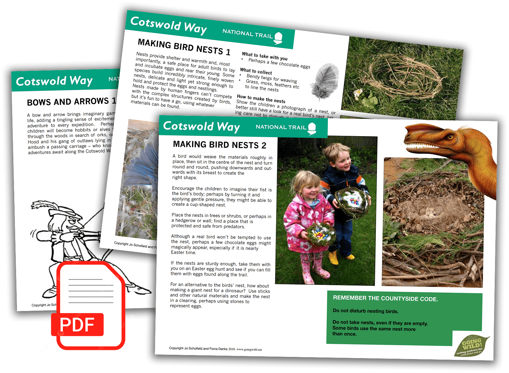
Planning


